Rare antique maps captivate history buffs and collectors alike, offering glimpses into the world as it was once imagined. These maps tell stories of exploration, discovery, and even the unknown. Each piece is a unique artifact, reflecting the cartographer’s skill and the knowledge of their time. The following maps are among the most sought-after, each with its own rich history.
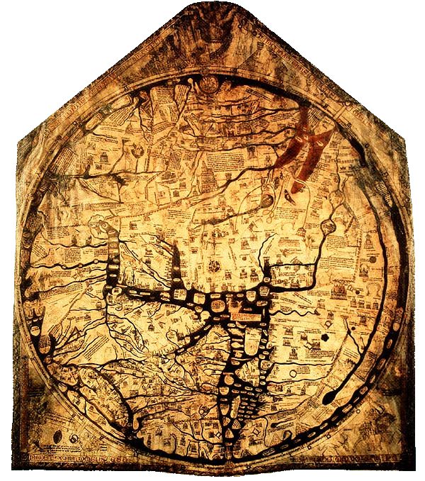
The Hereford Mappa Mundi (c. 1300)
This medieval map is the largest surviving example of a mappa mundi, created around 1300. It is drawn on a single sheet of vellum, measuring 1.58 by 1.34 meters. The map displays a blend of religious imagery and geographical knowledge of the time, with Jerusalem at its center. The Hereford Mappa Mundi is housed in Hereford Cathedral, UK. Due to its historical significance, it is considered priceless, though some experts estimate its value could be over $50 million.
The Tabula Rogeriana by Al-Idrisi (1154)
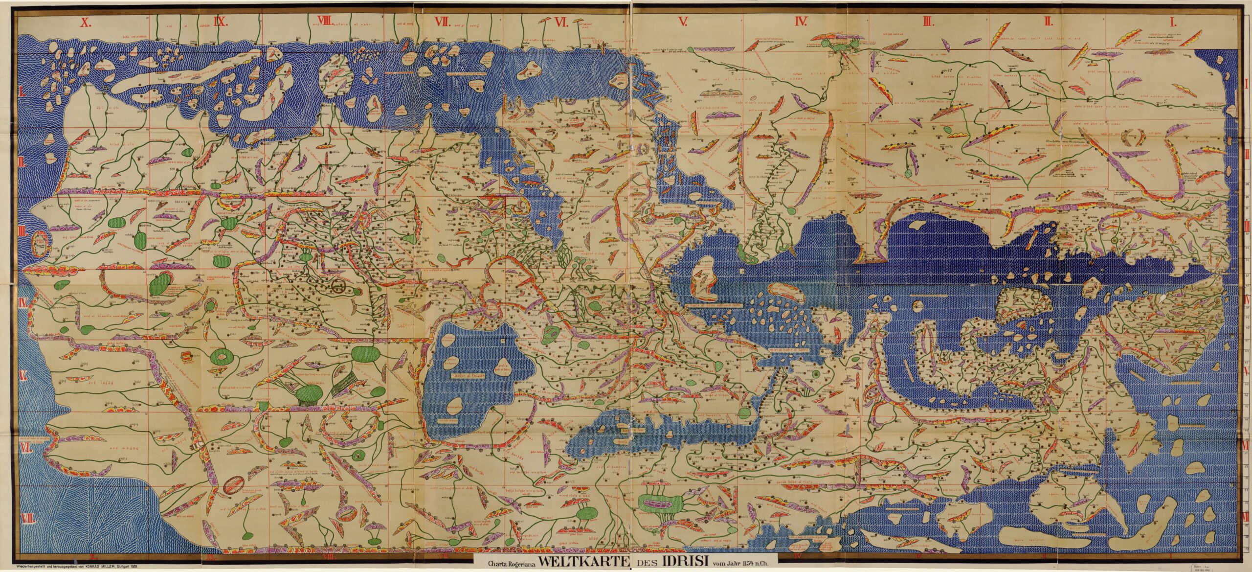
The Tabula Rogeriana, created in 1154 by Al-Idrisi, is one of the most advanced medieval maps. Commissioned by King Roger II of Sicily, it accurately depicts the known world with the south at the top, as was customary in Islamic cartography. This map shows Europe, North Africa, and Asia with remarkable precision. Original copies are exceedingly rare, and while the map’s historical importance is immense, its value could range between $5 million and $10 million.
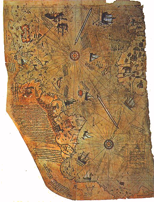
The Piri Reis Map (1513)
The Piri Reis Map, created by the Ottoman admiral and cartographer Piri Reis in 1513, is renowned for its detailed depiction of the coasts of Europe, North Africa, and Brazil, along with a mysterious portion of the Antarctic coast. The map’s blend of ancient knowledge with new discoveries makes it highly prized. Given its unique historical significance, the map is estimated to be worth between $10 million and $15 million.
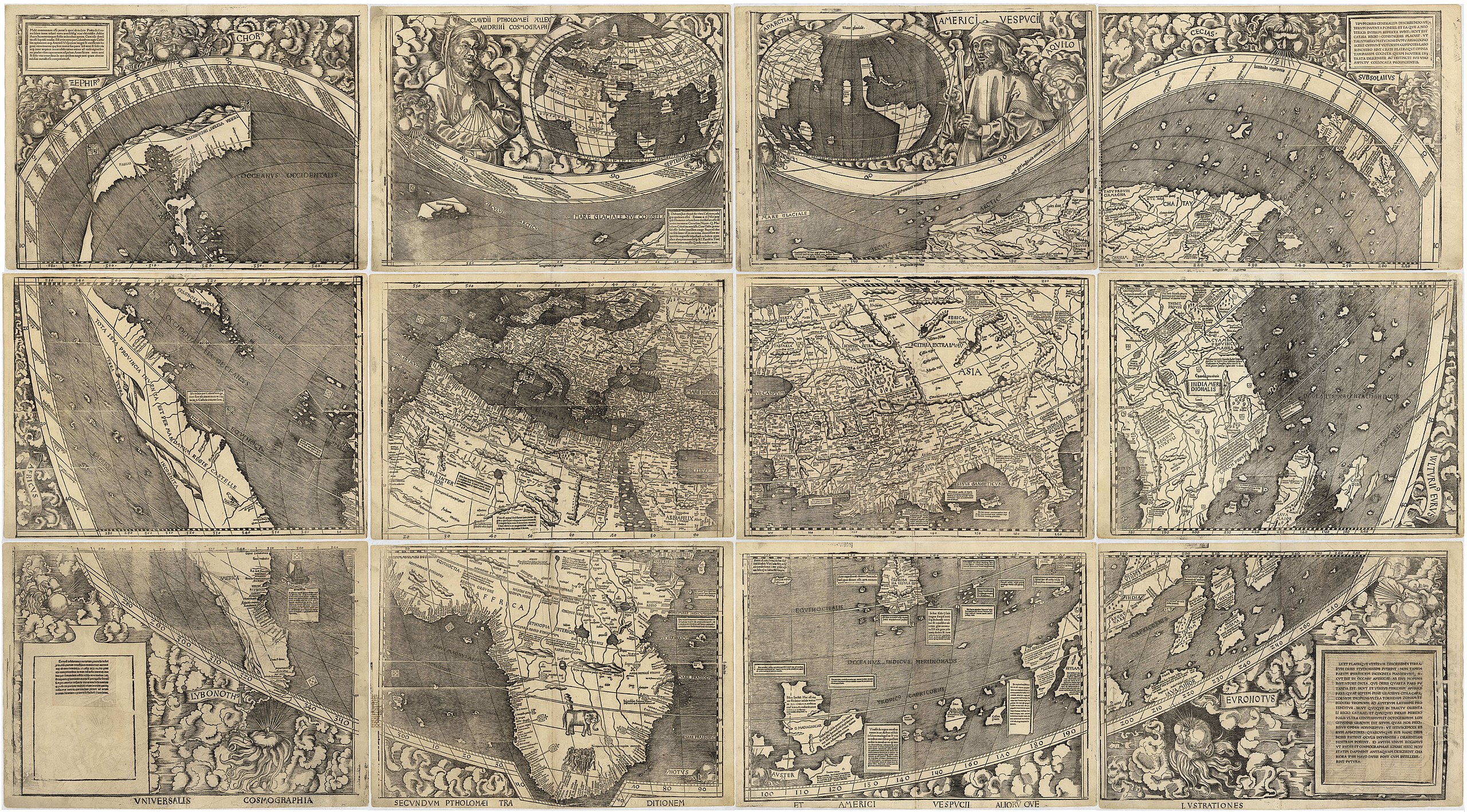
The Waldseemüller Map (1507)
The Waldseemüller Map of 1507, known as “America’s Birth Certificate,” is the first map to use the name “America” to label the New World. Created by German cartographer Martin Waldseemüller, this map revolutionized European views of the world. The only known surviving copy is preserved by the Library of Congress and was purchased for $10 million in 2003. Its current value is estimated to be between $15 million and $20 million.
The Cantino Planisphere (1502)
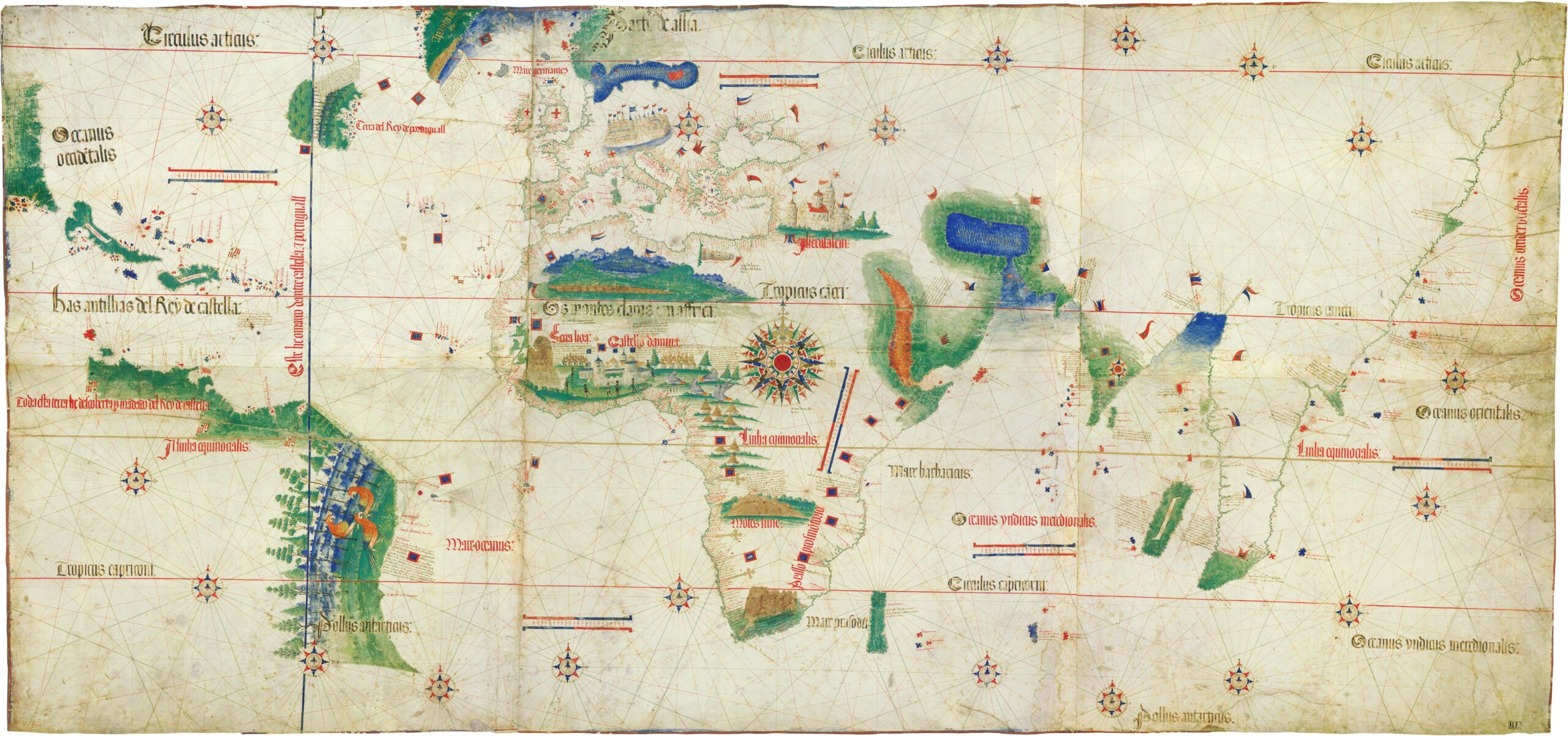
.jpg)
The Cantino Planisphere, created in 1502, is an early world map showing Portuguese discoveries. Named after Alberto Cantino, who smuggled it from Portugal, this map is highly valued for its accuracy in depicting the coastlines of Brazil and Africa. The Cantino Planisphere is a critical artifact in Renaissance mapping, with an estimated value of around $10 million.
The Ebstorf Map (13th Century)
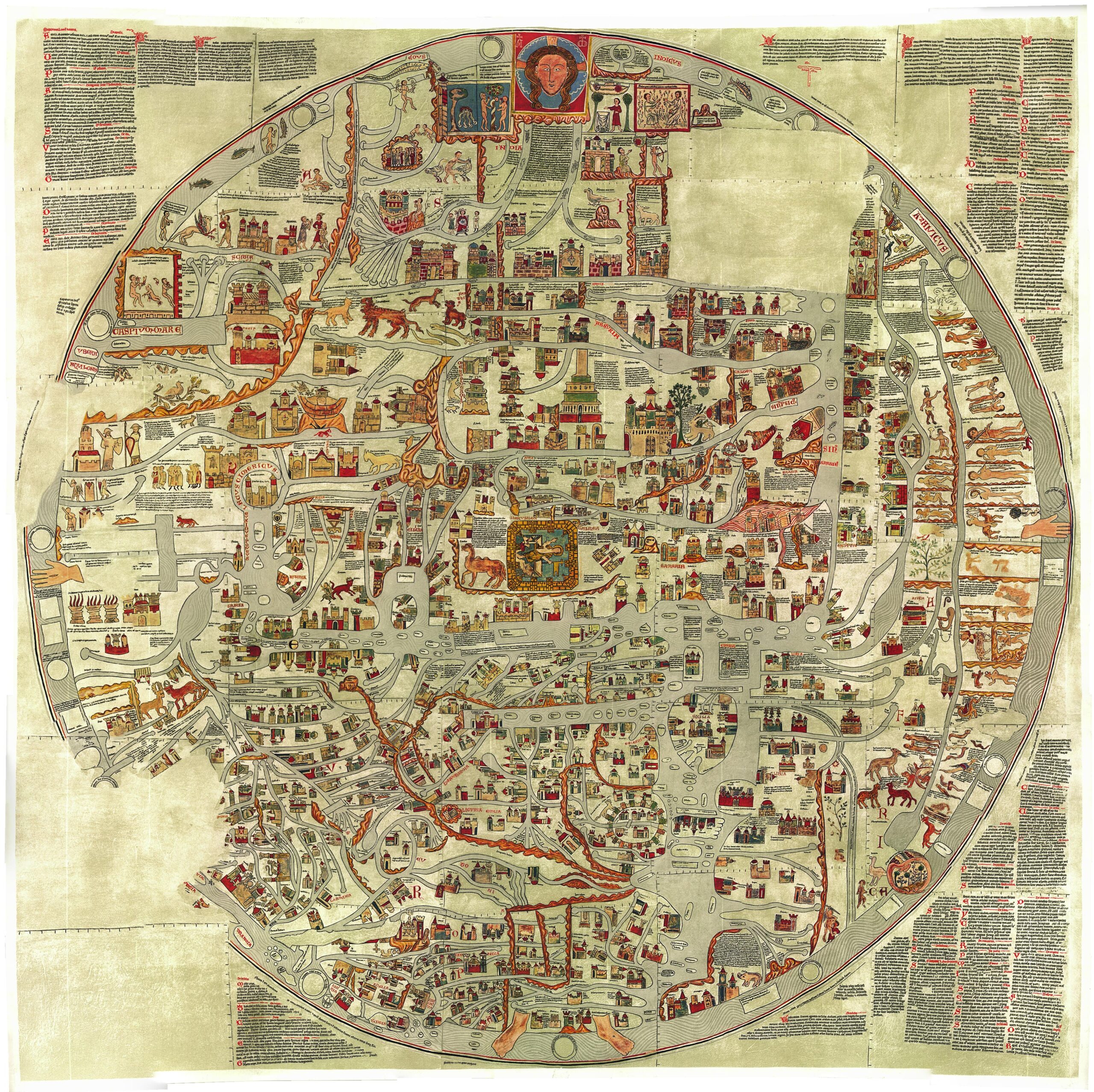
The Ebstorf Map, created in the 13th century, was the largest medieval world map ever made, measuring about 3.5 meters in diameter. Though it was tragically destroyed during World War II, copies and reproductions remain. Due to its symbolic and religious significance, the original map would likely be valued at over $20 million if it still existed today. However, surviving reproductions and fragments are estimated to be worth between $2 million and $5 million.
The Gough Map (c. 1360)
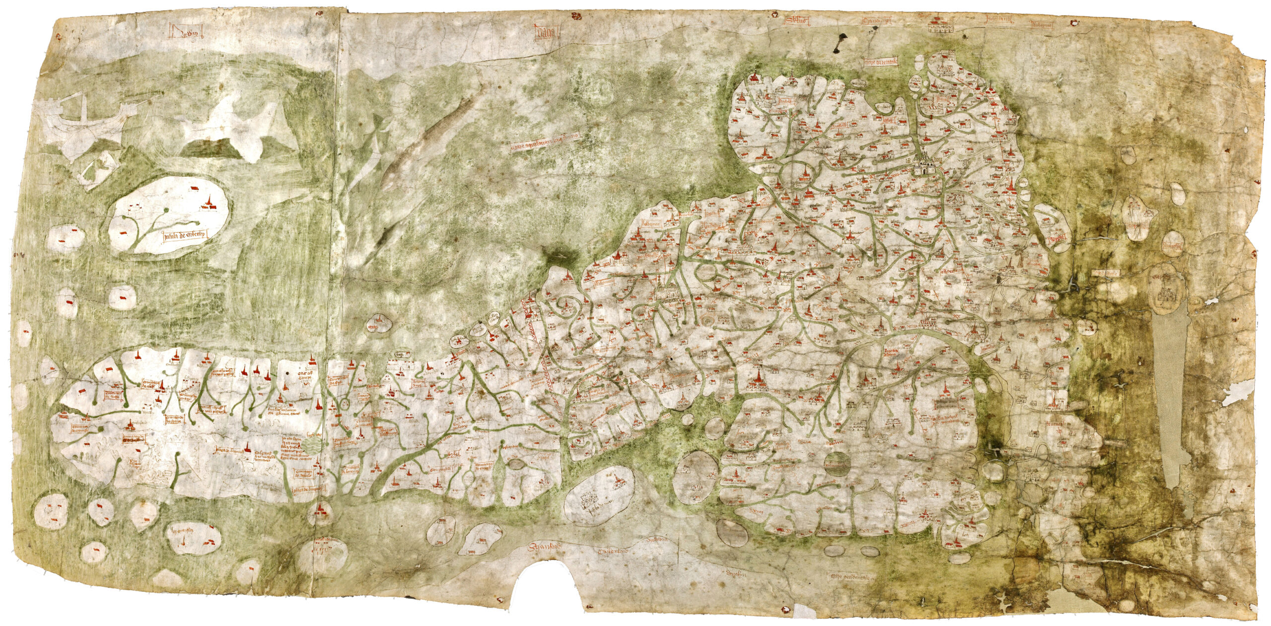
.jpg)
The Gough Map, dating from around 1360, is one of the oldest surviving road maps of Great Britain. It provides a surprisingly accurate representation of England and Scotland’s geography. This map is named after Richard Gough, who donated it to the Bodleian Library. Given its unique historical and geographical importance, the Gough Map is estimated to be worth between $8 million and $12 million.
The Psalter World Map (1265)
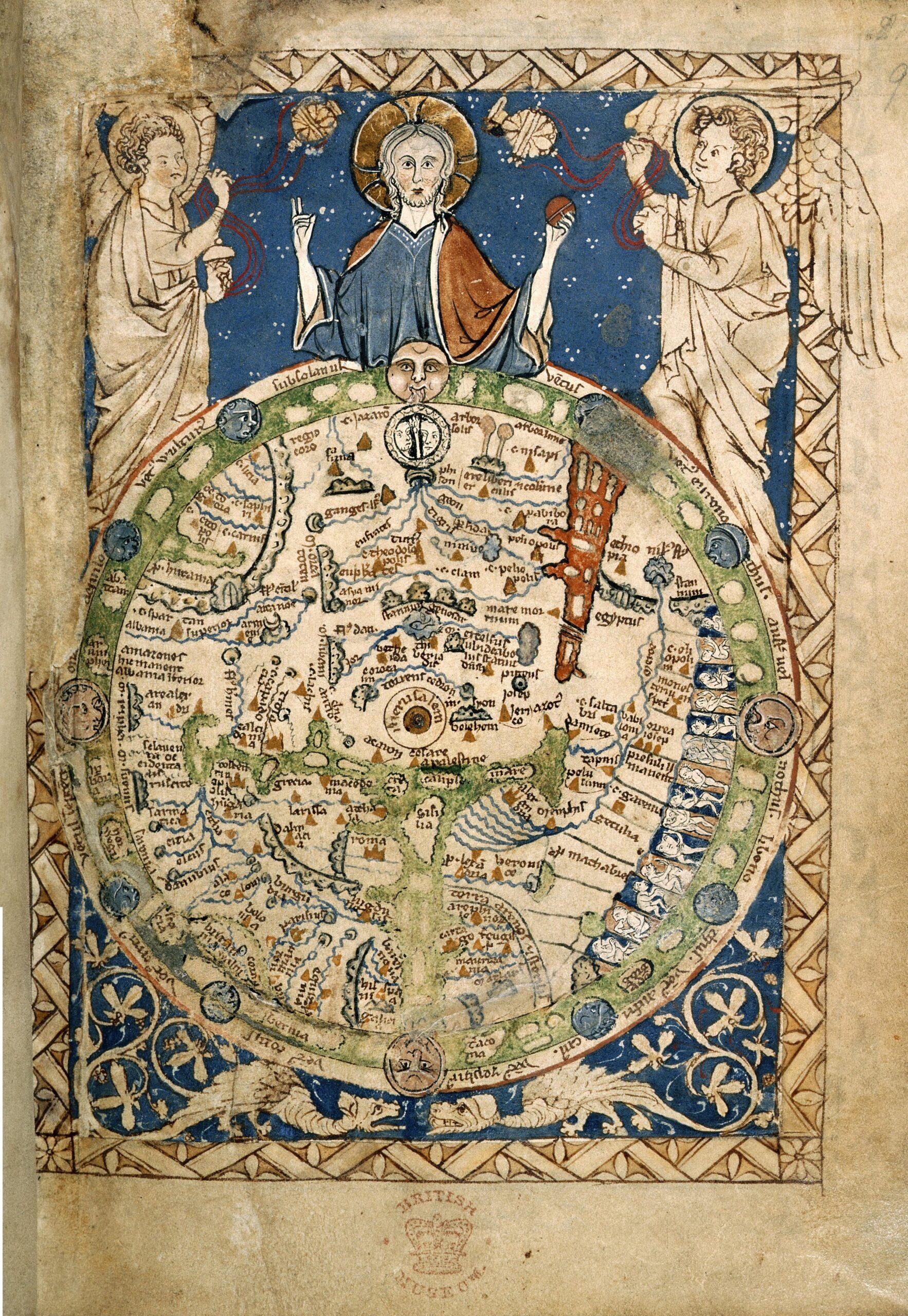
The Psalter World Map, created in 1265, is a medieval mappa mundi. It’s small but richly detailed, fitting within a Psalter, or book of Psalms. This map places Jerusalem at the center, reflecting the religious worldview of its time. It’s known for its intricate depictions of biblical scenes and mythical creatures. Collectors prize this map for its historical and religious significance. Few copies exist, making it exceptionally rare. The exact value is hard to determine, but it’s considered invaluable to those who appreciate medieval cartography.
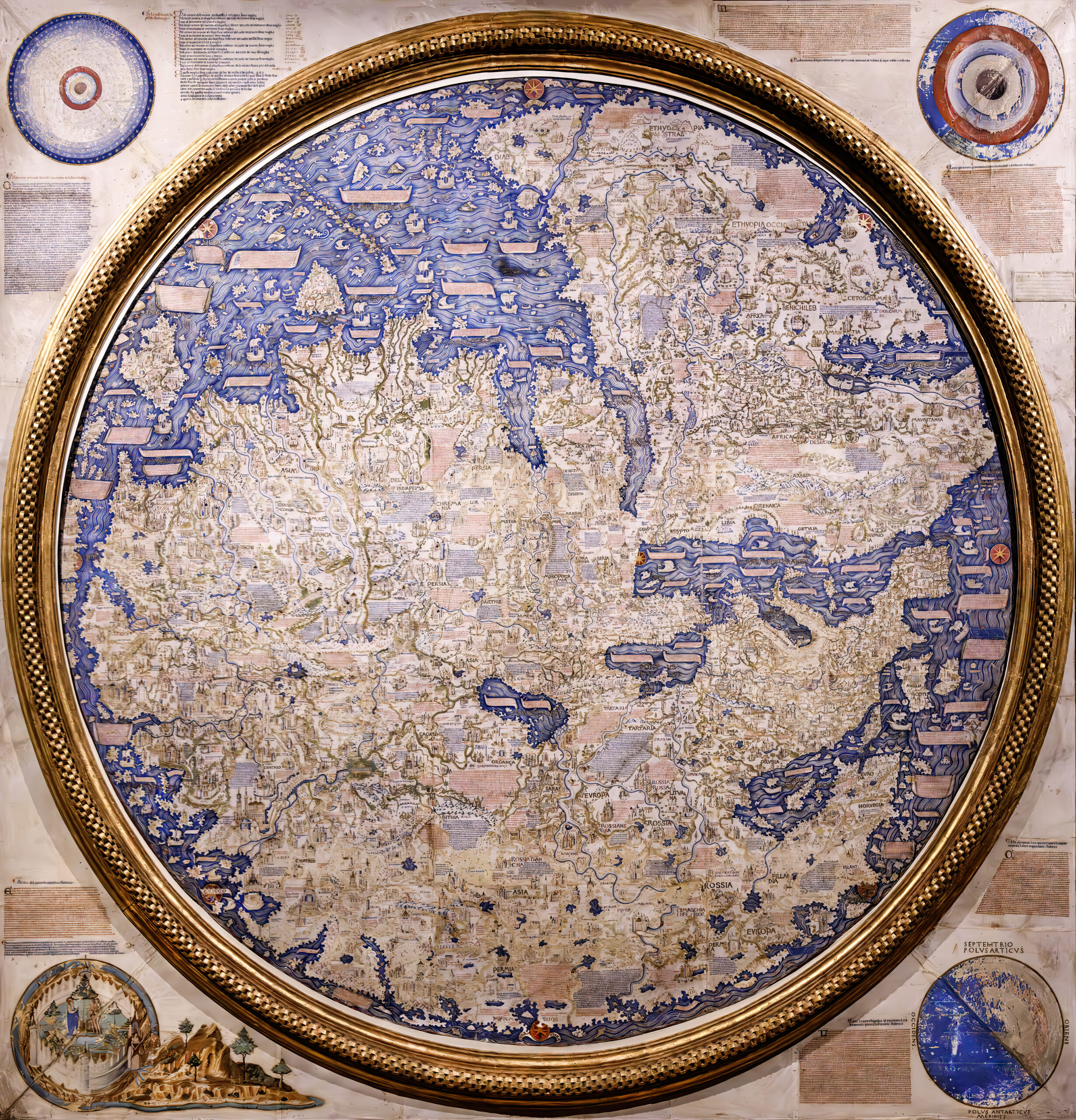
The Fra Mauro Map (c. 1450)
_Fra%27Mauro%27s_World_Map_-_Biblioteca_Nazionale_Marciana.jpg)
The Fra Mauro Map, crafted around 1450 by the Venetian monk Fra Mauro, is a circular map oriented with south at the top. It accurately captures the known world at the time, including Europe, Asia, and parts of Africa, and features detailed depictions of trade routes and settlements. The map’s artistry and cartographic precision make it highly valuable. The original map is considered priceless and is housed in Venice, but detailed reproductions can sell for upwards of $50,000, depending on the quality and provenance.
The Mercator World Map (1569)
The Mercator World Map, created in 1569 by Gerardus Mercator, introduced the revolutionary Mercator projection, which preserves accurate angles for navigation. It depicted the world with remarkable detail, including newly discovered lands. This map’s influence on cartography is immense. Original copies of the Mercator World Map are exceedingly rare. One of the few surviving originals sold for approximately $3.5 million at auction, reflecting its unparalleled historical and navigational significance.
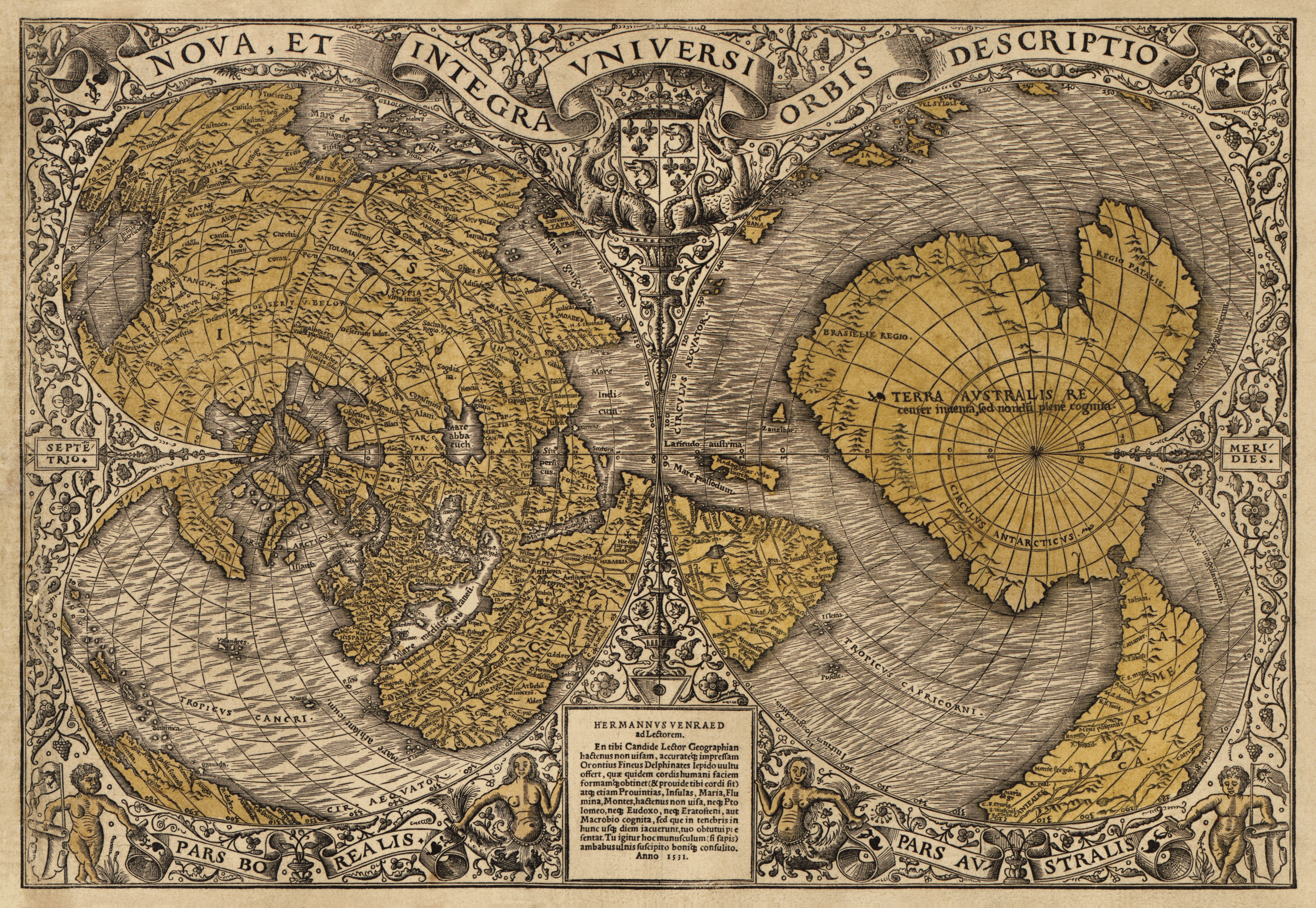
Oronce Finé’s World Map (1531)
Oronce Finé’s World Map, published in 1531, is famous for its heart-shaped projection and was among the first to depict the Americas as separate continents. The map’s unique shape and detailed depictions of the world make it a collector’s favorite. Few originals survive. Those that do are extremely valuable, often commanding prices around $600,000 to $800,000 at auctions due to their rarity and artistic importance.
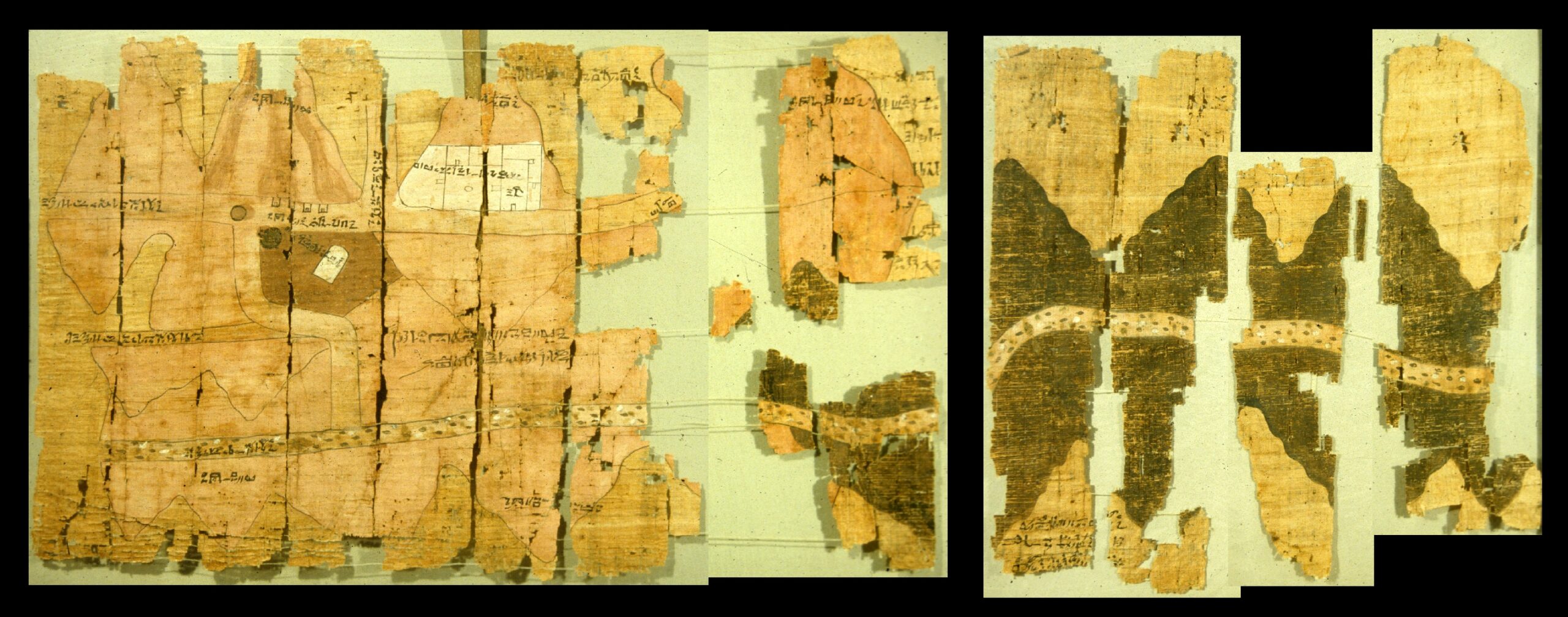
The Turin Papyrus Map (c. 1160 BC)
The Turin Papyrus Map, dating to around 1160 BC, is the oldest known topographical map, showing ancient Egyptian gold mines in Nubia. This map is remarkable for its accuracy and provides valuable insights into ancient Egyptian cartography. Drawn on papyrus with annotations in hieratic script, it is a rare and precious artifact. The exact value is difficult to estimate, but similar ancient artifacts have been valued at over $10 million, reflecting its historical significance and rarity.
The Klencke Atlas (1660)
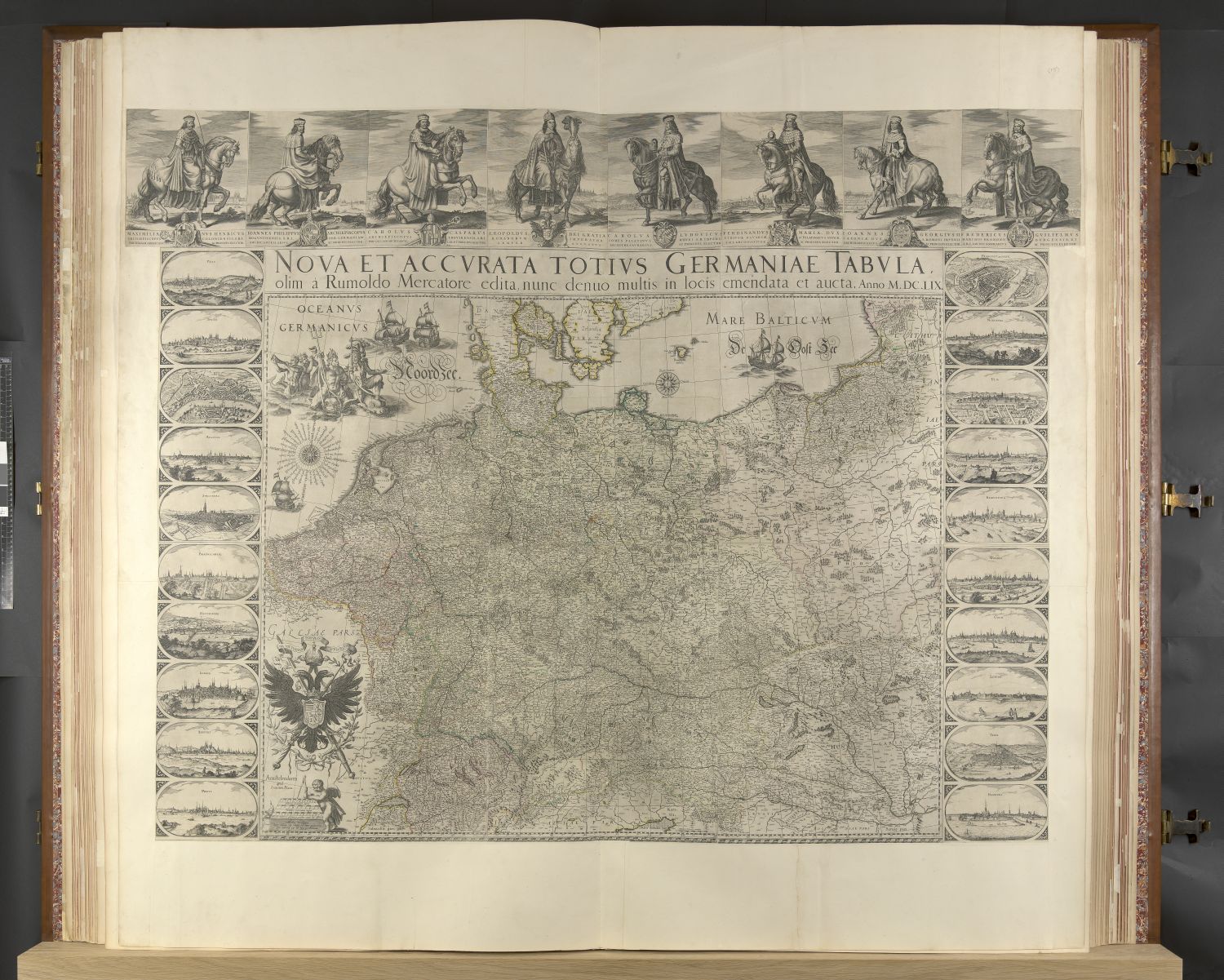
The Klencke Atlas, created in 1660, is one of the largest books in the world, containing 41 large-scale maps. It was a gift to King Charles II of England and symbolizes 17th-century cartographic achievement. The atlas is priceless due to its historical significance and grandeur. If it were ever sold, experts estimate its value could easily exceed $10 million, given its uniqueness and the quality of the maps it contains.
The Zeno Map (1380)
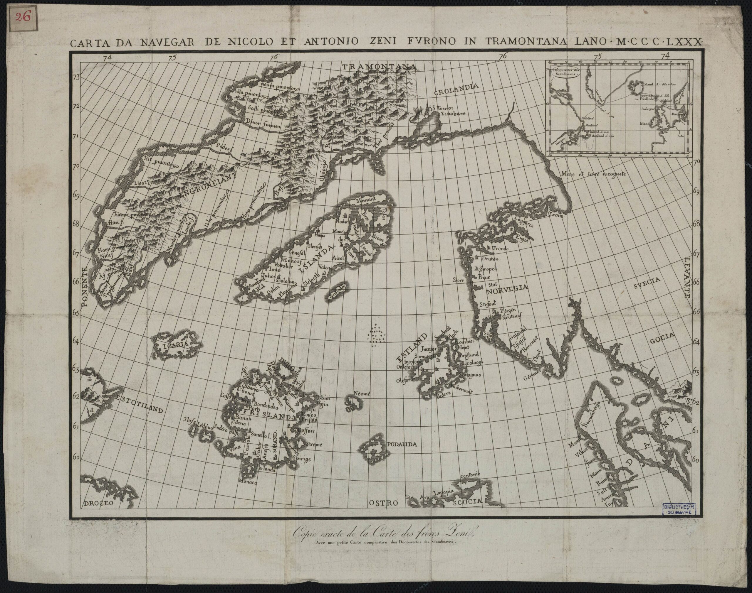
The Zeno Map, created in 1380, is a controversial and mysterious map that purportedly shows parts of the North Atlantic, including Greenland and Iceland. It’s claimed to be based on the explorations of the Zeno brothers. The map is intriguing due to its depictions of islands that don’t exist, leading to debates about its authenticity. Despite the controversy, it’s a fascinating piece of cartographic history. Collectors and historians are captivated by its mystery. Original copies of the Zeno Map are incredibly rare and can be valued at around $1 million to $2 million.
The Blaeu’s Atlas Maior (1662)
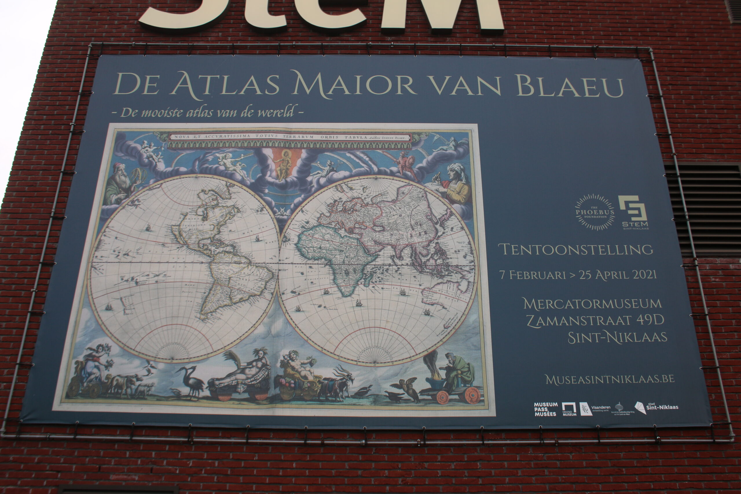
The Blaeu’s Atlas Maior, published in 1662, is one of the most comprehensive and beautifully crafted atlases of the 17th century. It contains over 600 maps and thousands of pages of text, covering the entire known world. The atlas is renowned for its detailed and decorative maps, each a masterpiece of cartography and art. Collectors highly value this atlas for its historical significance and its exquisite craftsmanship. A complete and well-preserved copy of Blaeu’s Atlas Maior can fetch between $300,000 to $600,000 at auction, depending on its condition.
The Vinland Map (15th Century)
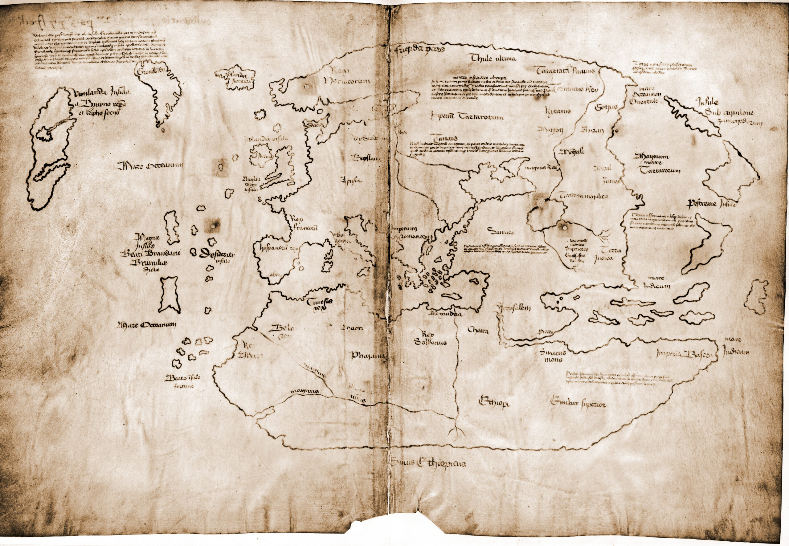
The Vinland Map, believed to be from the 15th century, is one of the most controversial maps in history. It allegedly shows part of North America, suggesting that Vikings explored the continent before Columbus. The map has sparked debates about its authenticity, with some experts claiming it’s a forgery. Regardless of the controversy, it remains a significant piece of cartographic history. The Vinland Map is extremely rare, and if proven authentic, it could be worth over $25 million. Even as a disputed artifact, it holds immense value for collectors.
The Portolan Charts (13th–17th Century)
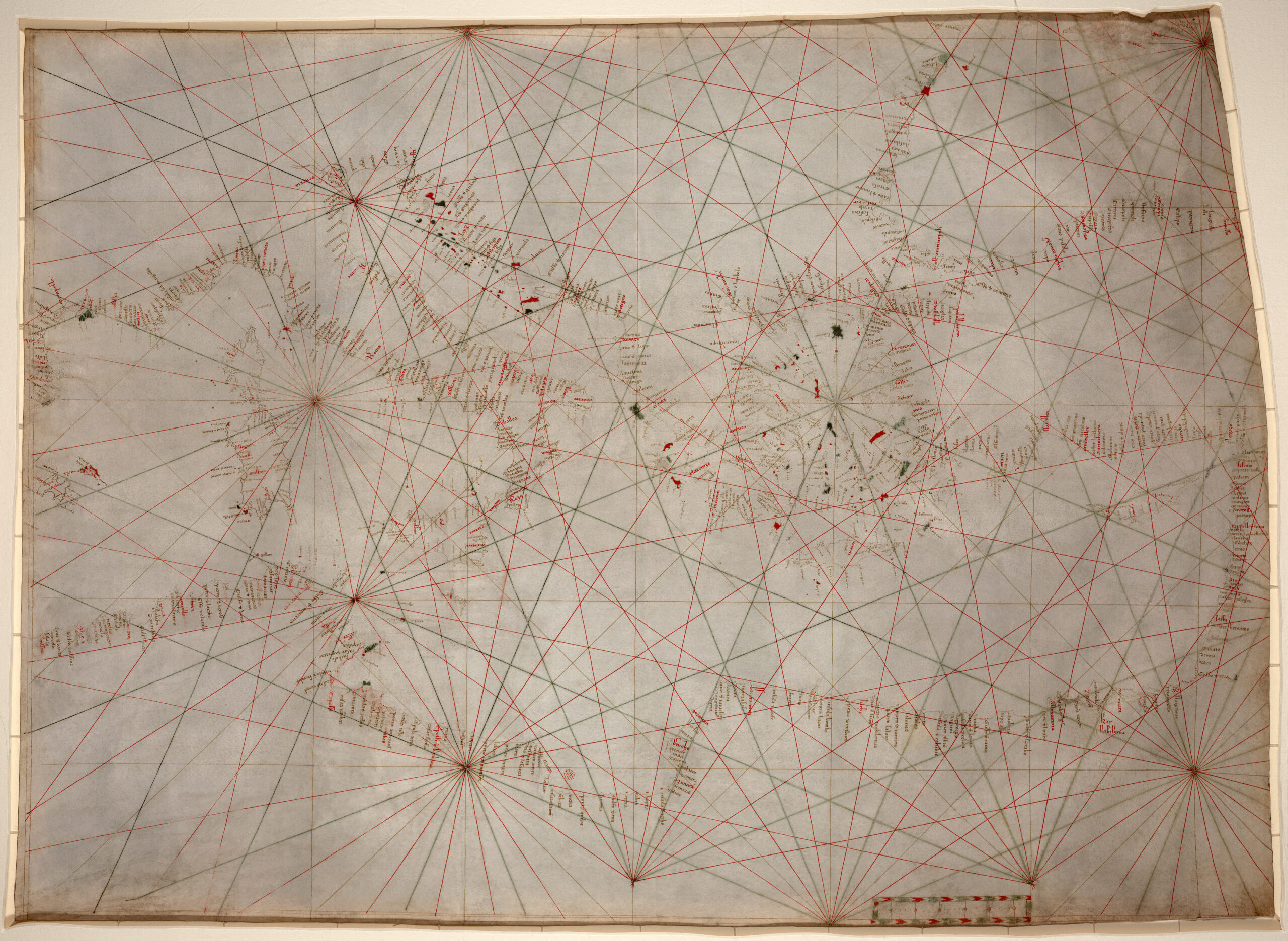
The Portolan Charts, created between the 13th and 17th centuries, are some of the earliest and most accurate nautical maps. These charts were used by sailors to navigate the Mediterranean and other seas. They are known for their precise coastlines and compass roses, making them valuable tools for navigation. Each chart is unique, often decorated with intricate details and symbols. Collectors admire these maps for their historical significance and their role in the development of modern cartography. The value of a Portolan Chart can range from $100,000 to $1 million, depending on its age, condition, and provenance.
The Catalan Atlas (1375)
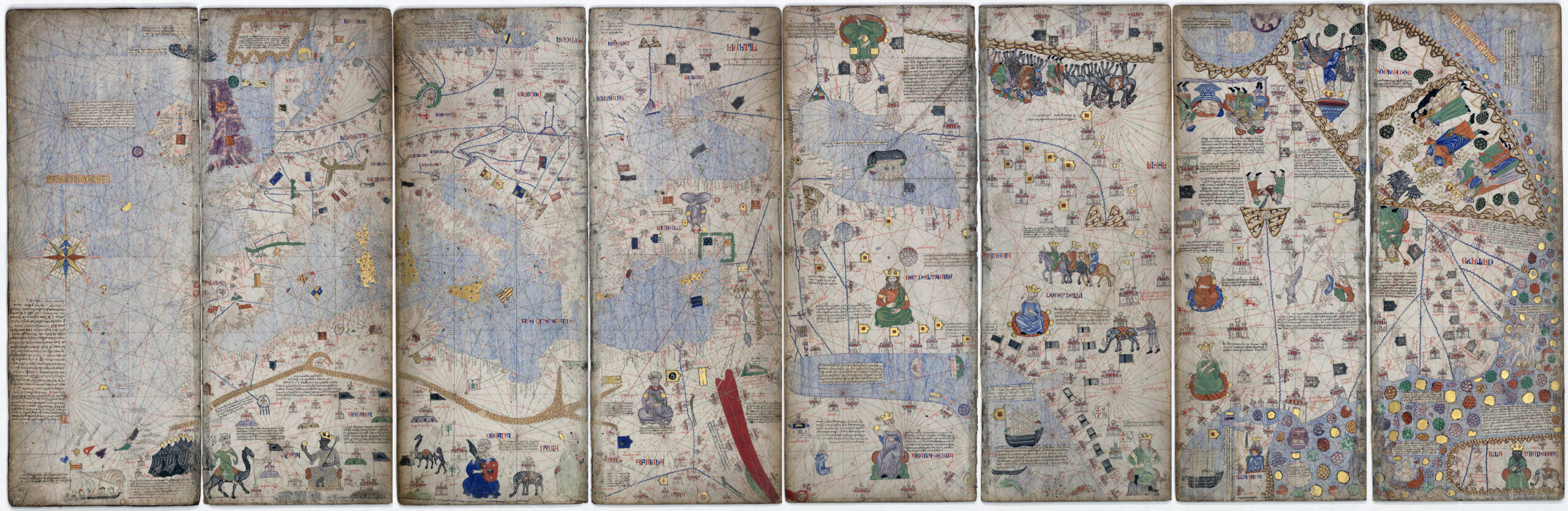
The Catalan Atlas is one of the most famous medieval world maps. It was created in 1375 by the Majorcan cartographer Abraham Cresques. This map stands out for its detailed depictions of trade routes, cities, and exotic lands. Each part of the map is richly illustrated with vibrant colors and gold leaf. Collectors highly value it for its rarity and artistic beauty. The original is priceless and held in the National Library of France. However, if it were to come to market, experts estimate it could fetch over $10 million.
The Behaim Globe (1492)
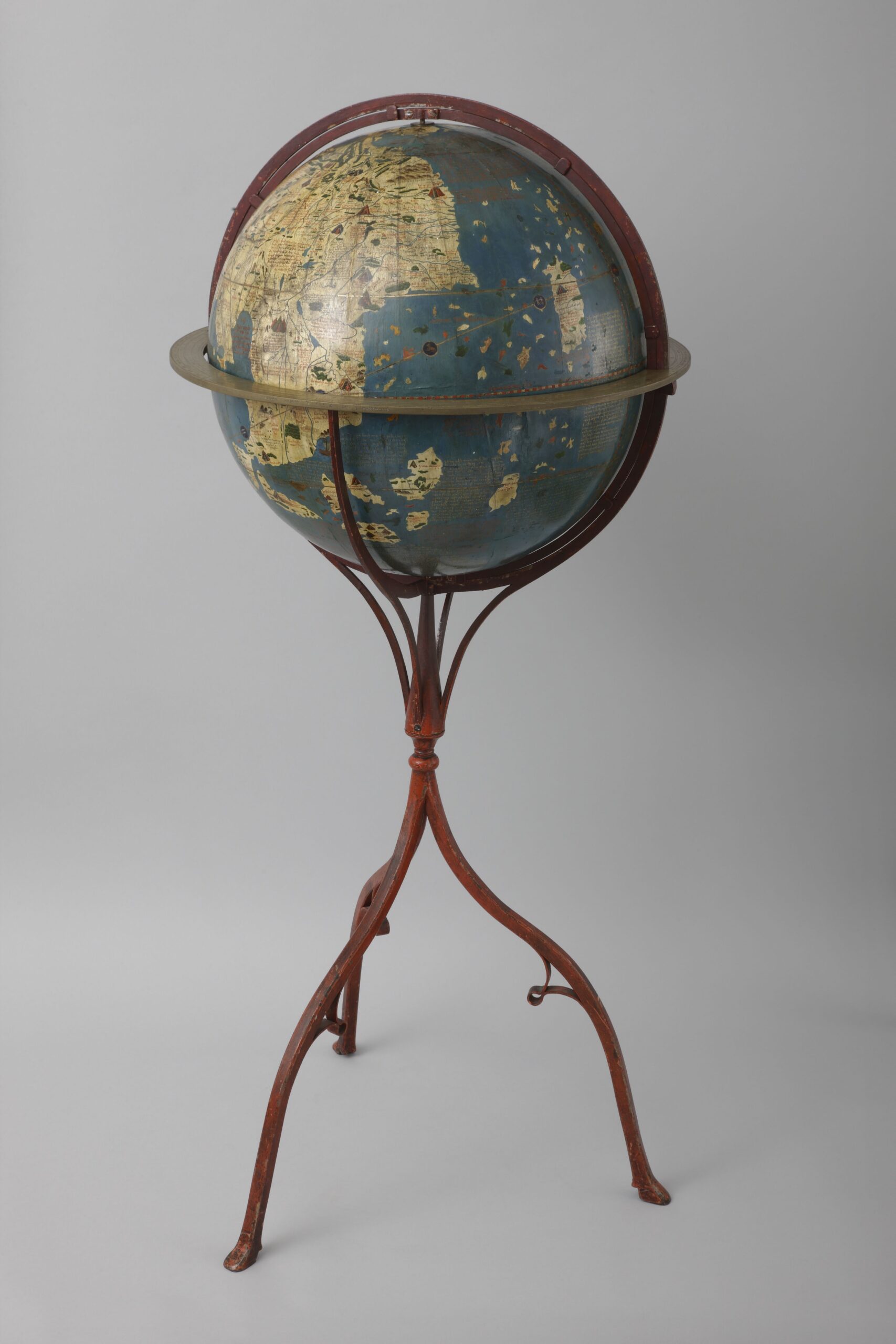
_-_de_Martin_Behaim_-_btv1b55008737g_(1_of_3).jpg)
The Behaim Globe is the oldest surviving terrestrial globe. Created in 1492 by Martin Behaim, it represents the world before Columbus’s discoveries. The globe is made of a linen-covered sphere, painted with great care. It shows the Earth centered on Europe, with parts of Asia and Africa. This globe is a remarkable artifact of pre-Columbian cartography. The original is housed in the Germanisches Nationalmuseum in Nuremberg and is considered invaluable. A similar piece, if available, could potentially be worth around $5 million.
This article originally appeared on Rarest.org.
More from Rarest.org
1939 Mercury Dime Value Guide
Despite its small size, the Winged Liberty Head dime, more commonly known as the Mercury dime, might be the most attractive coin the US Mint has ever made. Read More.
1941 Lincoln Penny Value Guide
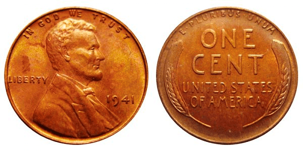
The 1941 Lincoln Penny is a one-cent coin having a face value of $0.01. The penny is made of 95% copper and 5% tin and zinc mixture. Read More.
20 Animals Saved by Captive Breeding Programs

Captive breeding programs have played a crucial role in saving some of the world’s most endangered species from extinction. Read More.